
New Flood Inundation Prediction Tool
Posted on: January 10, 2020 - 7:45am
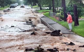
If you live in Ozaukee County near portions of Cedar Creek or the Milwaukee River, wouldn’t it be helpful to predict when your property may flood? New interactive maps available in a new tool can now show you where flooding may occur using data collected at stream gages. These maps are intended to lower future costs for response, repair and recovery by improving protections and evacuation options prior to floods.
The National Weather Service partnered with the Wisconsin DNR and Wisconsin Emergency Management to produce the maps with funding from the Federal Emergency Management Agency.
Learn more at https://dnr.wi.gov/topic/floodplains/inundation.html